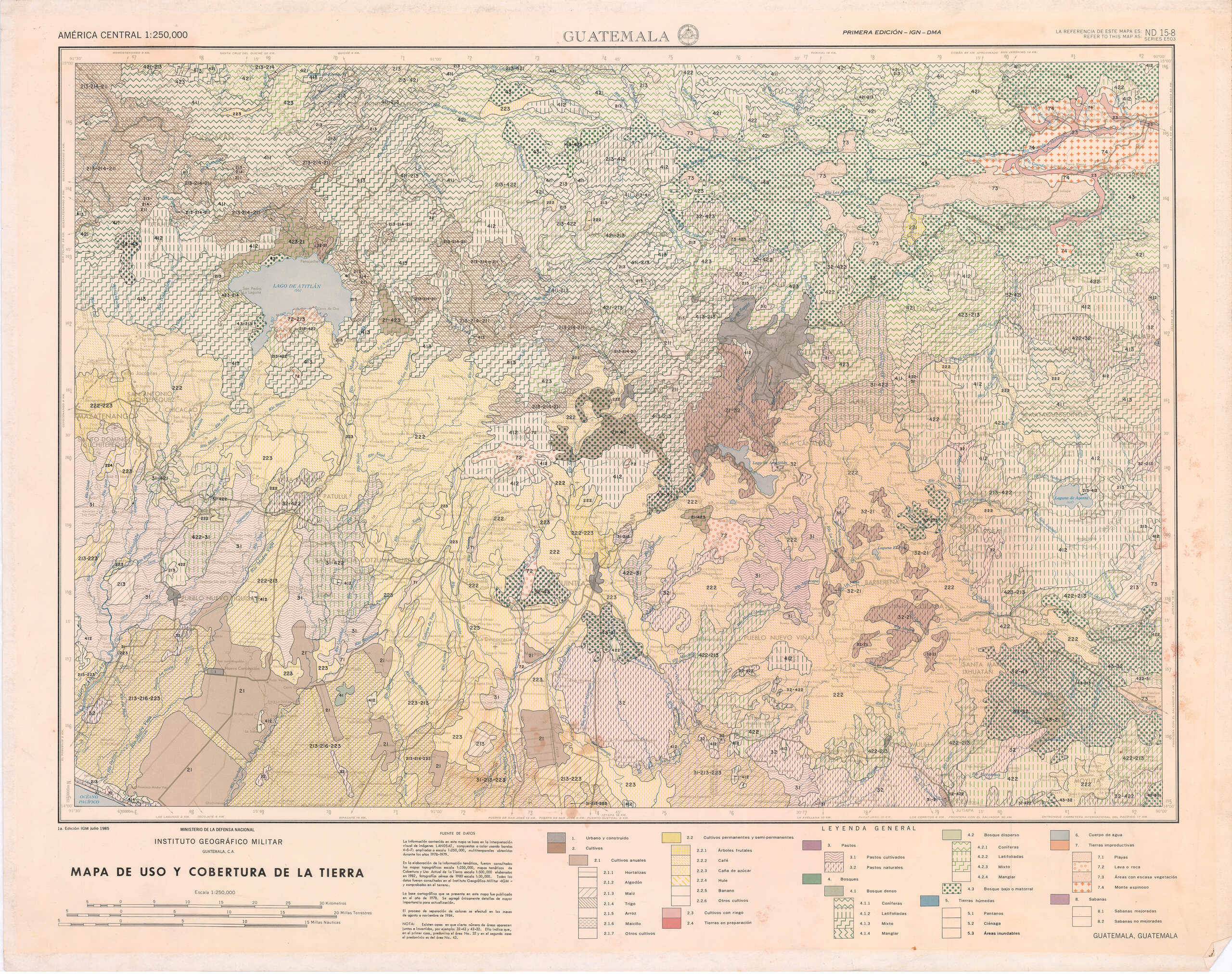
“Uso y Cobertura de la Tierra”, 1:250,000
Instituto Geográfico Militar, 1985. Developed from LANDSAT imagery and topographic maps.
This map shows how new satellite imagery was being used to develop land-use maps during the heat of Guatemala’s civil war.